Omnitrack

$11,900.00

SKU:

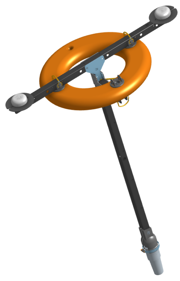
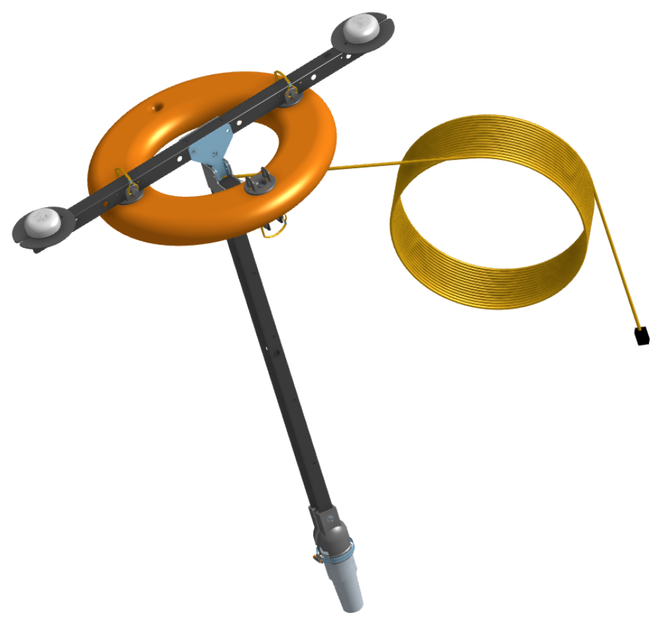
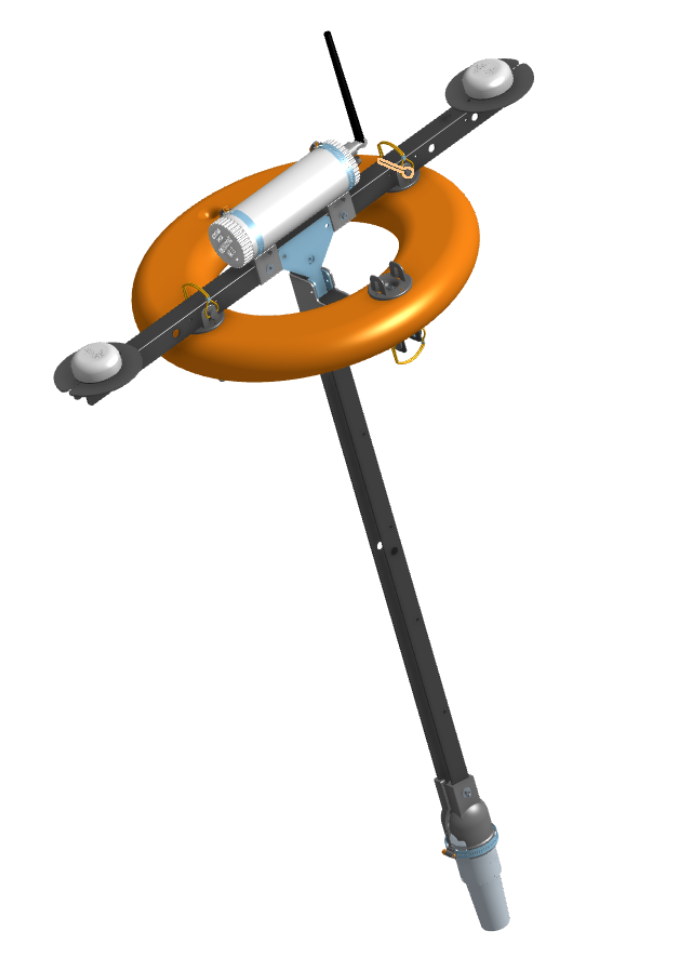
The Omnitrack system represents the latest generation of underwater positioning solutions from Cerulean Sonar. At its core is the Omnitrack surface module—a ring buoy that combines Cerulean’s ROVL Mk. III with dual GNSS receivers to deliver robust global positioning of underwater targets. In addition to providing accurate global position for the topside module, the dual GNSS units also determine heading, eliminating issues caused by magnetic interference.

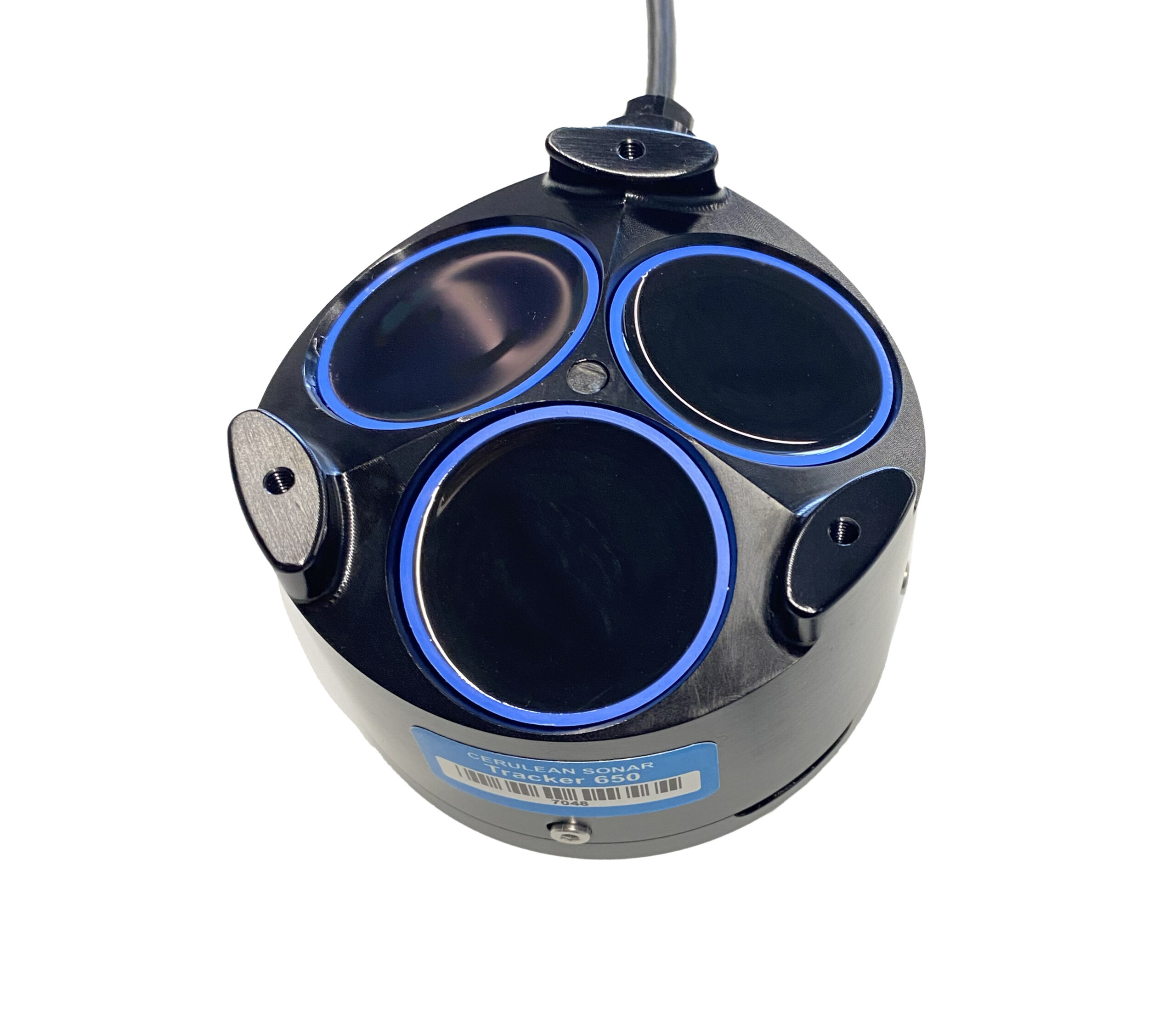
The Omnitrack has been designed to interface directly with the BlueROV (and optionally our Tracker-650 DVL) to enhance the ROV’s internal position estimate.

There are wired and wireless options available for the surface module.

GNSS Heading and Position

Heading derived from magnetometers is notoriously prone to magnetic interference, especially around metal structures or electronic equipment. That’s why the Omnitrack uses a dual GNSS setup to provide robust heading and global position without relying on magnetic sensors. When in GNSS denied environments, the onboard magnetometer provides a fallback so you’re never completely lost.

ROVL Mk III

Our proven Mark III ROV Locator is integrated directly into the Omnitrack topside module. Using the interrogate/response model of a traditional USBL system, it eliminates the need for distance sync at mission start and avoids time-consuming crystal calibration procedures. Just mount the transponder module on your ROV or target, add power, and you’re ready to track.

Designed with the BlueROV in Mind

The Omnitrack module sends real-time position updates directly to the BlueROV’s mavlink2rest server. When used with a BlueROV, Cerulean’s Tracker 650 can also operate alongside the Omnitrack. When properly configured, ArduSub fuses data from both the USBL and DVL to produce a highly accurate, drift-free position estimate. However, Omnitrack can also be used independently of the BlueROV—data can be collected and visualized using Cerulean’s SonarView software.

What’s in the Box

  • Ring Buoy mounting set (ring, struts,  mounting hardware)
  • ROVL Mk III (Ethernet) Omnitrack Bundle (Transceiver, Transponder, ROV mount)
  • Dual GNSS Compass Antennae
  • Basic maintenance tool set
  • 30 meter Omnitrack Ethernet Power-Over-Ethernet (POE) tether OR Long range Wi-Fi Module with Battery

Specifications

Maximum Depth Exposure (minimum crush depth)

300m

Maximum Range

300m

Apparent Yaw/Azimuth resolution

0.1°

Apparent Elevation angle resolution

0.1°

Slant range measurement resolution

0.1m

Update rate

1Hz

Ping Frequency

25 kHz

NOTE : Resolution does not equal accuracy.

Related Products